Outdoor Trail Maps
See offer

3,9 out of 5
★★★★★
★★★★★
5 reviews
| 5 ★ |
|
| 4 ★ |
|
| 3 ★ |
|
| 2 ★ |
|
| 1 ★ |
|
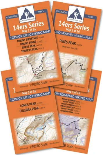
Colorado 14ers Series Front-Tenmile-Mosquito Range Map Pack
- + Includes detailed topographic maps
- + Comprehensive coverage of Front, Tenmile, Mosquito Range
- + Durable and waterproof material
- + Ideal for hikers and climbers
The Front-Tenmile-Mosquito Range Map Pack of the Colorado 14ers Map Series covers all of the Colorado 14ers found in the Front Range, Tenmile Range and Mosquito Range of Colorado across four maps (Map 1, Map 2, Map 3, and Map 4) - as well as Culebra Peak in the Sangre de Cristo Range.
Peaks include:
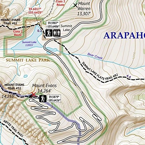
- Mount Bierstadt, Mount Blue Sky (formerly Mount Evans), Grays Peak, Torreys Peak (Map 1)
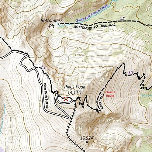
- Pikes Peak - East and West (Map 2)
- Longs Peak, Culebra Peak (Map 3)
- Mount Sherman, Mount Bross, Mount Cameron, Mount Democrat, Mount Lincoln and Quandary Peak (Map 4)
This map pack saves you 12% off the retail price of these maps than if purchased separately. These rugged trail maps were designed for on-trail use in the toughest outdoor conditions in a compact and easy-to-fold size - no more fumbling with huge, inaccurate maps while on the go.
- ALL the trails - not just the standard routes
- Waterproof and tear-resistant paper, utralight weight – under an ounce
- Detailed 1:30,000 scale (1 inch ≈ ½ mile), distances for all trail segments
- Compact folded size to fit in your pocket – only 3.8” x 6.5” folded and 13" x 19" unfolded
- GPS compatible: coordinates for all 14er trailheads - not just the popular ones - and for key trail junctions
| Item Weight | 4 Ounces |
|---|---|
| Brand Name | Outdoor Trail Maps |
| Manufacturer | Outdoor Trail Maps LLC |
| Part Number | 978-1-946906-17-5 |
| ASIN | 1946906174 |
| Customer Reviews | 3.9 3.9 out of 5 stars 5 ratings 3.9 out of 5 stars |
| Best Sellers Rank | #338,606 in Sports & Outdoors (See Top 100 in Sports & Outdoors) #75 in Camping & Hiking Topographic Maps |
| Date First Available | June 26, 2017 |

Outdoor Trail Maps
Colorado 14ers Map Pack
🔥
See offer