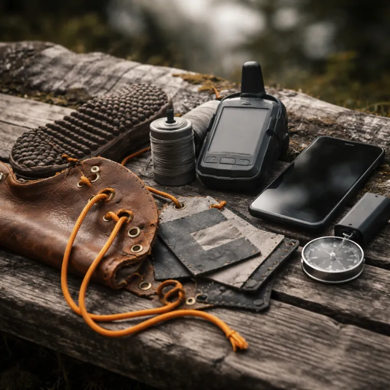
Apple satellite SOS vs Garmin inReach when your boots leave the trailhead
Apple satellite SOS vs Garmin inReach is really a question about how far your trips go. When your hiking boots carry you beyond the last reliable cell service bar, the difference between a phone based beacon and a dedicated satellite communicator becomes brutally clear. Think less about shiny gear and more about who actually answers when you press that tiny red sos feature in a storm.
On paper, the apple iphone emergency feature looks generous for hikers and mountaineers. Since late 2022, iphone satellite connectivity has used the Globalstar low Earth orbit network, which Apple’s own coverage map shows as reaching much of North America and Europe plus parts of Australia and East Asia, but leaving big holes over oceans, high latitudes, and much of the Global South. As of 2024, Apple lists support in roughly twenty countries including the United States, Canada, the UK, France, Germany, Australia, and Japan, with more being added gradually. For a weekend member of the day hiking crowd in Yosemite or the Lake District, that free apple satellite SOS will feel like a safety net that just works most of the time.
Garmin inReach leans on the Iridium inreach satellite network, which offers near global coverage including Patagonia, Alaska, the Himalayas, and the Greenland ice sheet according to Iridium’s published footprint. When you compare Apple satellite SOS vs Garmin inReach in those environments, the inreach satellite communicator is not a luxury but core safety gear. The inreach mini and other garmin inreach models keep sending satellite messaging from deep valleys where an iphone works only as a camera and topo map viewer.
Think about your last serious trip in real terrain, not a roadside overlook. Maybe you pushed 25 km days on the GR20 in Corsica, or threaded talus fields in the Wind River Range with wet boots and a heavy pack. On those routes, a phone satellite beacon that only talks to emergency services in limited regions will never replace a dedicated inreach iphone pairing that lets you text, share a precise location satellite fix, and update plans when the weather turns.
For the serious backpacker, Apple satellite SOS vs Garmin inReach is less about tech specs and more about mission profile. If your hiking boots rarely leave popular national park loops, the iphone satellite option is a rational compromise that will continue to be enough. Once your trips stretch more than five hours from a trailhead or cross remote passes, a garmin inreach unit becomes as essential as a broken in pair of boots and a reliable water filter.
There is also a psychological gap between a one way emergency sos and true two way messaging. With Apple satellite SOS, your apple iphone connects to a relay center that then contacts local emergency services, but you do not have the same conversational back and forth that a garmin inreach member enjoys with Garmin Response. When you are shivering under a bivy at 3 000 m, that difference in messaging depth shapes decisions, morale, and ultimately how well your rescue will be coordinated.
Coverage maps, real mountains, and when a free phone lifeline fails
Coverage maps are where the Apple satellite SOS vs Garmin inReach debate stops being theoretical. Apple clearly states that iphone satellite connectivity is limited to specific countries and regions, which means your phone satellite lifeline simply does not exist in many classic expedition zones. If your hiking boots are pointed toward the Alaska Range, the Cordillera Blanca, or remote sections of the Continental Divide Trail, relying on an apple iphone alone is a calculated risk.
Take a typical summer traverse of the Wind River High Route in Wyoming, where granite passes and deep basins block both cell service and clean lines to low orbit satellites. In that terrain, an iphone works beautifully as a navigation phone with offline maps, but Apple satellite SOS may struggle with line of sight and will not offer continuous satellite messaging for daily check ins. A clipped to harness inreach mini or other garmin inreach device, by contrast, keeps chirping away on the Iridium network with enough redundancy to punch through brief sky windows.
Now shift to Patagonia, where katabatic winds and fast moving storms turn minor ankle sprains into real emergency scenarios. Here the Apple satellite SOS vs Garmin inReach comparison is stark, because Globalstar coverage is patchy while Iridium blankets the region, so a dedicated inreach satellite communicator has worked time and again for guided groups and solo mountaineers. When you hit that sos feature on a garmin unit, Garmin Response can coordinate with local emergency services even when your service phone back home is out of reach and your family only has location sharing links.
For European GR routes like the GR5 or Tour du Mont Blanc, the calculus shifts again. These trails weave through valleys with villages, road crossings, and often at least intermittent cell service, so an iphone satellite backup is a reasonable layer on top of your normal phone calls. In this context, Apple satellite SOS vs Garmin inReach tilts toward the iphone for cost conscious hikers who still want a way to reach emergency services without paying a monthly membership fee for a satellite communicator they rarely use.
Battery life also plays differently across these scenarios, and your boots will feel the weight of extra power banks. A garmin inreach device is a dedicated tool with multi day battery life when used for occasional satellite messaging and tracking; Garmin quotes up to 14 days for an inreach mini 2 in 10 minute tracking mode with a good sky view, while independent reviewers such as Outside Online have reported more than a week of real world use on mixed trips. An apple iphone, by contrast, drains quickly when running navigation apps, photos, and an always ready sos feature, and heavy users often need to recharge daily or every other day. On a weeklong unsupported trek, that means you either carry more battery weight for the phone or accept that your emergency channel might die before your last camp.
When you add in real camp life, from cooking on a reliable two burner propane stove to drying soaked socks by the flame, the pattern is clear. You already trust dedicated gear for critical tasks like boiling water and lighting camp, because multitools rarely beat purpose built equipment in harsh weather. The same logic applies to Apple satellite SOS vs Garmin inReach, where a dedicated inreach iphone pairing behaves more predictably than a multi role phone that juggles maps, photos, and emergency calls.
From 911 loops to Garmin Response: who actually picks up your SOS
Under the hood, Apple satellite SOS vs Garmin inReach is really about the human on the other end of the line. When you trigger the sos feature on an apple iphone, the phone satellite link connects you to an Apple operated relay center that then contacts local 911 or equivalent emergency services. That loop works well in developed regions with robust dispatch systems, but it is not the same as a specialized mountain rescue coordination hub.
Press the SOS button on a garmin inreach device and you enter a different ecosystem entirely. Your inreach satellite signal routes to Garmin Response, a dedicated team that handles thousands of incidents and maintains a playbook for backcountry rescues, maritime emergencies, and remote expeditions. In the Apple satellite SOS vs Garmin inReach comparison, this means a garmin inreach member benefits from staff who understand that a broken ankle 20 km from the nearest road in the Pyrenees is not the same as a twisted knee in a city park.
Two way satellite messaging is the second big split between these systems, and it matters more than any spec sheet suggests. With Apple satellite SOS, you can answer scripted questions and share your location satellite coordinates, but you cannot hold an open ended conversation about changing weather, alternate exit routes, or evolving medical symptoms. A garmin inreach or inreach mini, paired with an iphone or used alone, lets you exchange detailed texts, send updates to family, and adjust rescue plans in real time as conditions shift.
For your hiking partners at home, Apple satellite SOS vs Garmin inReach also changes how they track your progress. Apple offers some iphone satellite based location sharing features, but they are limited compared with the continuous LiveTrack style options on a garmin inreach device. When your spouse or climbing partner can watch your breadcrumb trail from a laptop, they become an informal part of the safety net, spotting stalled movement long before any emergency services are called.
Integration with other gear is another angle that serious hikers should weigh carefully. An apple watch can relay emergency alerts and fall detection through your iphone when cell service exists, but it does not become a full satellite communicator on its own in remote zones. Garmin, by contrast, has begun weaving inreach satellite features into high end watches and bike computers, so your wrist unit can share messaging duties with the dedicated inreach mini clipped to your pack strap.
Night travel adds yet another layer, when your world shrinks to the beam of a reliable rechargeable headlamp and the crunch of your boots on scree. In those hours, fiddling with a touchscreen phone to manage an emergency feels clumsy compared with the tactile buttons of a garmin inreach device designed for gloved hands and rain. Apple satellite SOS vs Garmin inReach then becomes a question of interface under stress, not just which app has the slicker feature list.
Practical recommendations: which hikers can rely on Apple, and who still needs inReach
So where does Apple satellite SOS vs Garmin inReach land for real hikers who care more about boot fit than brand keynote slides. Start with your trip profile, not your phone model, and be brutally honest about how remote your routes actually are. If your longest days stay within a few hours of a road and mostly inside countries where iphone satellite coverage is confirmed, the apple iphone emergency feature is a reasonable baseline.
For that weekend day hiker or casual backpacker, the combination of an iphone, an apple watch for fall detection, and solid navigation apps covers a lot of ground. Apple satellite SOS will continue to provide a last ditch lifeline when cell service drops, and you can save the cost of a garmin inreach membership for better boots or a lighter tent. In this band of use, the main discipline is power management, because your emergency channel shares battery life with photos, maps, and entertainment.
Once your trips stretch into multi day routes, shoulder season storms, or off trail passes, the balance flips decisively. A compact inreach mini or similar garmin inreach unit becomes part of your standard gear list, right alongside your stove, insulation layers, and repair kit. In these scenarios, Apple satellite SOS vs Garmin inReach is not a close call, because the dedicated inreach satellite communicator offers global coverage, richer messaging, and a professional response center that has worked time after time for serious expeditions.
Thru hikers on trails like the Pacific Crest Trail or Continental Divide Trail sit in a gray zone that still tilts toward Garmin. Large segments of these routes wander far from reliable cell service and outside the most robust iphone satellite coverage zones, especially in northern sections and high desert plateaus. Carrying a garmin inreach paired with an iphone gives you redundancy, location sharing for family, and the ability to call for help even when weather, smoke, or detours push you off the planned line.
Budget always enters the conversation, but it should not dominate it. The upfront cost of a garmin inreach plus ongoing membership fees looks steep until you weigh it against the price of boots, travel, and time invested in a major trip, not to mention the value of a coordinated rescue when things go wrong. Apple satellite SOS vs Garmin inReach is really a question of acceptable risk, and for any outing where a night out becomes life threatening, the dedicated device wins.
Finally, remember that communication tools are only one layer in a broader safety system that includes weather savvy, navigation skills, and appropriate clothing like modern PFAS free rainwear. Your boots, pack, and emergency gear form a coherent whole, and Apple satellite SOS vs Garmin inReach should be evaluated within that context, not as a standalone gadget decision. In the end, what saves you is rarely the waterproof rating or the marketing headline, but the tenth river crossing when your systems still work and your satellite communicator still has battery life.
Key figures for Apple satellite SOS vs Garmin inReach in backcountry use
- Garmin has reported coordinating more than 3 000 inReach SOS incidents in a recent year, with hiking and backpacking representing a significant share of those activations according to Garmin public summaries.
- The Iridium satellite network used by garmin inreach devices offers near global coverage, including polar regions, while the Globalstar network used for iphone satellite connectivity covers selected regions and leaves notable gaps over oceans and high latitude areas as shown on each provider’s published coverage maps.
- Typical battery life for an inreach mini 2 in 10 minute tracking mode can reach multiple days of continuous use, with Garmin quoting up to about two weeks under ideal conditions, whereas a heavily used iphone running navigation apps and occasional satellite messaging often requires daily charging based on field tests by reviewers at outlets such as Outside Online.
- Apple’s satellite SOS feature is currently limited to iphone 14 and later models, while garmin inreach devices function independently of any specific phone generation, which affects long term upgrade costs for hikers who prefer to keep a stable navigation and communication setup.
- Many national park search and rescue teams in North America report that a growing proportion of successful self initiated rescues involve satellite messaging devices, including garmin inreach units, which provide precise GPS coordinates and two way communication that streamline response times compared with voice only 911 calls.